


The swell of the year (so far)
Typhoon Mawar originated as a tropical depression in the warm waters of the western Pacific Ocean. It rapidly intensified due to favourable atmospheric conditions, such as warm sea surface temperatures and low wind shear. As the depression organised and winds began to circulate around a well-defined centre, it gained strength and evolved into a tropical storm. The Joint Typhoon Warning Center (JTWC) assigned the name Mawar to this developing system.
As Typhoon Mawar moved northwestward, it encountered an environment conducive to further intensification. With abundant moisture, low vertical wind shear, and a well-established outflow pattern, the storm underwent a period of rapid strengthening. Its central pressure dropped significantly, and maximum sustained winds reached an impressive Category 4 strength on the Saffir-Simpson Hurricane Wind Scale.
The forecast
This is the first time that XL waves were forecasted for the Taiwanese east coast, with Surfline reporting 20-25ft waves on the day the swell was supposed to peak.


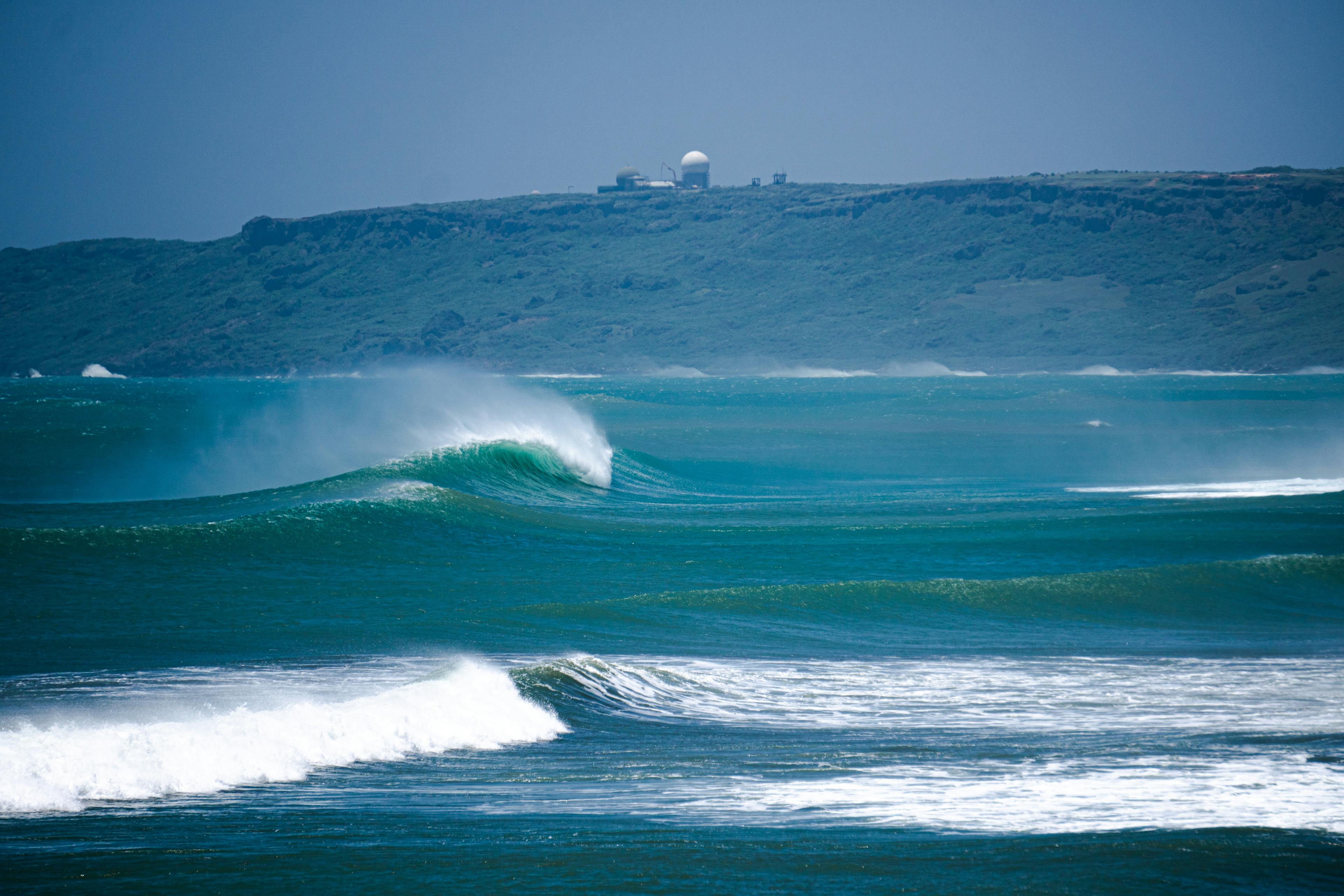
The swell reduced slightly in size as it edged closer to the Taiwanese coast.
The initial days of swell closed out all south east coast breaks with south coast breaks such as Dawan, Nanwan and other secret spots firing and offshore.
If you haven't yet, make sure to check out our YouTube raw video of a session in Nanwan here.

As the typhoon got closer and closer to Taiwan a sea warning was put in place for the east coast and all beaches were closed, surprisingly and unfortunately, the same happened for the beaches on the south coast.
As the typhoon moved north, Jialeshuei on the east coast had the best conditions with powerful head/overhead waves and strong offshore winds

In other parts of Taiwan the swell was big and powerful and made the surfing conditions very challenging.
Overall tricky conditions ensued all over Taiwan, but the typhoon graced local chargers for a couple of intense days of pumping and solid surf.
With the probable El Nino year this year we're looking forward to hopefully what is going to be a busy typhoon season, with the next typhoon already on the charts and about to hit the east coast this weekend. Stay tuned for more reports.
While you are here make sure to follow us on Instagram and get timely updates and videos on the swell situation in southern Taiwan!
Thanks for reading and stay tuned for our next update